|
ALERT
BAY
Alert Bay is on the small island of Cormorant, and can be reached
by ferry from Port McNeill, which is just off Hwy19, and 200km (124mi)
north of Campbell River. Fishing and tourism keep this community
lively.
BAMFIELD
This out-of-the-way salmon fishing centre is on the southeast
side of Barclay Sound. During the summer, sports fishermen use it
as a base to fish Barclay Sound and Alberni Inlet. Many others come
to hike, scuba dive and canoe
CAMPBELL RIVER
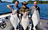
Campbell River, historically renowned as the "Salmon Capital
of the World", is surrounded by Strathcona Provincial Park to the
west and the Coastal mountain range to the east. Campbell River
is 50 km (31 mi.) north of Courtenay on Highway 19, 270 km (167
mi.) north of Victoria and 235 km (146 mi.) south of Port Hardy.
It is served by BC Ferries from Campbell River to Quadra Island
(3 km/2mi.).
CHEMAINUS
Located on Stuart Channel, just east of Hwy 1, 78km (46.5mi)
north of Victoria is Chemainus. Local artists have make it "Canada's
largest outdoor art gallery". The 32 large murals, painted on downtown
walls, depicting the history of the area, are more than just a local
attraction. It's said that over 250,000 people from far and wide
come to see these murals.
COMOX
Comox is 6 km (4 mi.) east of Courtenay, off Highway 19. It
is served by BC Ferries from Powell River (27 km/17 mi.). Summer
or winter, the Comox Valley has something to offer any outdoor enthusiast:
golf courses, hiking, camping, fishing, skiing, photography, and
sightseeing.
COURTENAY
Courtenay is 60 km (37 mi.) north of Qualicum Beach on Highway
19 or 220 km (137 mi.) north of Victoria. Courtenay accommodations
include full-service hotels, motels and bed and breakfast establishments.
Many of these offer ski packages in the winter and salmon fishing
packages in the summer. There are also private and provincial campsites
available.
CUMBERLAND
This former coal mining town of Cumberland during its hey day
supported a population of approximately 10,000. The big Victorian
styled homes built at the turn of the century, are being restored.
Several building in the downtown area, that house art galleries
and craft shop, have been refurbished.
DUNCAN
The "City of Totems" is a major business centre for the farming
and forestry industries of the Cowichan Valley. Duncan is 60 km
(37 mi.) north of Victoria on Highway 1. The lakes and rivers surrounding
Duncan offer good freshwater fishing, canoeing and boating, while
the surrounding countryside is a haven for hikers, bikers, photographers
and sightseers.
GABRIOLA
ISLAND
Gabriola
is the most northerly of the Southern Gulf Islands and lies in the
Strait of Georgia between Vancouver Island and mainland British
Columbia. It is one of the most accessible in the Gulf Islands with
ferry service running daily, 16 times each way, a 5km/3mi, 20-minute
ferry ride from downtown Nanaimo.
GOLD
RIVER
The logging town of Gold River is located in the Gold River
Valley and can be accessed either by water or from Hwy 28 southwest
of Campbell River. The area offers the visitor excellent fishing
and caving.
GULF ISLANDS
Idyllic in landscape, rustic in character, the Gulf Islands
bask in a mild climate and pastoral tranquility. Almost 200 islands
of all shapes and sizes lie tucked against the southeastern shore
of Vancouver Island with only the invisible international boundary
dividing them from the San Juan Islands in US waters. The charming
island communities offering a variety of services and accommodations.
A must see for every BC visitor.
LADYSMITH
Ladysmith is 85km (53mi) north of Victoria on Hwy 1. The downtown
features restored heritage buildings, art galleries, gift and antique
shops. Take a walk along the natural deep harbour where you can
enjoy fishing, swimming or just relaxing.
LAKE COWICHAN
North of Duncan, take Hwy 18 to Lake Cowichan. Around Lake
Cowichan's shore is a network of nature walks. The Cowichan Valley
Demonstration Forest , located along the lake, on Hwy 18, provides
an outdoor classroom of forest management. Take your camera and
prepare for some picture postcard scenery.
NANAIMO
Nanaimo, known as the Harbour City, is Vancouver Island's second
largest city. For the outdoor enthusiast, the area in and around
Nanaimo offers hiking trails, a nature centre, bird sanctuary and
picnic and swimming sites plus great fishing opportunities. Nanaimo
is 26 km (16 mi.) north of Ladysmith or 110 km (68 mi.) north of
Victoria on Highway 1. It is served by BC Ferries from Horseshoe
Bay (Vancouver); a crossing time of 1 hour and 35 minutes and from
Tsawwassen it takes two hours.
NOOTKA ISLAND & NOOTKA SOUND
Wild, rugged and majestic are just a few words to describe Nootka Sound and Nootka Island off the West Coast of Vancouver Island.
PARKSVILLE
Parksville is located on the east coast of Vancouver Island,
37 km (23 mi.) north of Nanaimo, on Highway 19 or 144 km (89 mi.)
north of Victoria. Whether it is for camping, hiking, fishing, playing
on the beach or exploring the natural wonders of the area, Parksville
has something to offer everyone
PORT ALBERNI
Port Alberni is 50 km (31 mi.) west of Parksville or 121 km
(121 mi.) northwest of Victoria on Highway 4. With the increased
popularity of Pacific Rim National Park, Barkley and Clayoquot Sounds,
and the incredible sports fishing available, more and more visitors
are using their vacations in Port Alberni take day trips to a variety
of West Coast locations.
PORT ALICE
In 1965, Port Alice made history by becoming the first instant
town incorporated in B.C, although pulp and paper mills have operated
here since 1918. This is a good place for boat launching to fish
and explore the inlets along Quatsino Sound (west side of Vancouver
Island).
PORT HARDY
Port Hardy is often used as a "jumping off point " for those
wanting to explore the wonders of the northern part of Vancouver
Island; spectacular scenery, great fishing, whale watching and sightseeing.
Port Hardy, at the northern terminus of the Island Highway is 50
km (31 mi.) north of Port McNeill, on Highway 19
PORT MCNEILL
Port McNeill is the gateway to the northern part of the Island.
As well as being so close to the amenities and activities of the
north island, there are many recreation opportunities for the visitor
right in the Port McNeill area. Port McNeill is 200 km (124 mi.)
north of Campbell River, off Highway 19 or 50 km (31 mi.) south
of Port Hardy. BC Ferries has a sailing to Alert Bay (8 km) and
Sointula.
PORT RENFREW
To get to the west side of Vancouver Island, from Victoria,
take Hwy 14 to Sooke and then northwest to the end of the road,
which is at Port Renfrew. This small quaint settlement is located
at the mouth of the San Juan River and Port San Juan. Port Renfrew
is the southeast end of the Pacific Rim National Park's West Coast
Trail.
QUADRA ISLAND
A short ferry ride across Discovery Passage from downtown Campbell
River to Quadra Island is all it takes. Passengers disembark to
an idyllic island playground of beaches, lakes, and parks intermingled
with luxury lodges, native culture, artisan's studios, and other
interesting places that are friendly and welcoming.
QUALICUM BEACH
Facing the Strait of Georgia, its on Hwy 19 (the Island Highway)
and is only 10km (6mi) north of Parksville. This pleasant village
is close to the beach, and along the way there are quaint shops,
galleries and restaurants. Fishing and golfing are popular activities
in the area.
SAYWARD
70km (43mi) north of Campbell River on Hwy 19, turn east on
a paved road and travel for 10km (5.6mi) to the village of Sayward
and the Kelsey Bay Wharf. This serves as a centre for the Salmon
River valley area.
SIDNEY
Sidney is located 25 km (16 mi.) north of Victoria, on Highway
17. It is the terminus of the Washington State Anacortes and San
Juan Islands Ferry. Sidney offers the charm and character of a seaside
town complete with a wonderful variety of shops, museums and interesting
outdoor activities.
SOOKE
Located 34 km (21 mi.) west of Victoria, on Highway 14, Sooke
is a pleasant village on the southwest corner of Vancouver Island,
where visitors can explore its history, fish, and enjoy the outdoors.
In Sooke you can camp by the sea in one of the private or provincial
campsites, stay in a hotel/motel or enjoy a leisurely bed and breakfast.
TAHSIS
This forestry community at the head of Tahsis Inlet is 70km
(43mi) northwest of Gold River on a gravel road. Canoeing, kayaking,
caving, fishing, and hiking are all very popular in this region.
TELEGRAPH COVE
Established in 1911-12 during the building of the telegraph
line from Campbell River north to the tip of the Island. Later it
became a sawmill community and now is major destination for the
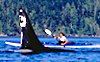
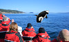
coastal wilderness, including whale-watching tours.
TOFINO
Tofino, on the northern boundary of Pacific Rim National Park
is a relaxed, casual place; a place to get back to nature. You can
walk for hours along the beach and explore pathways that lead through
the rainforest to secret coves and beach caves. Tofino is 42 km
(26 mi.) north of Ucluelet on Highway 4, 130 km (81 mi.) west of
Port Alberni and 337 km (209 mi.) northwest of Victoria.
UCLUELET
Leaving Port Alberni, Highway 4 travels west to climb around
Sproat Lake through the stunning mountain scenery of the Mackenzie
Range and along Kennedy Lake to reach the west coast of Vancouver
Island and the communities of Ucluelet and Tofino.
VICTORIA
Perched on the southernmost tip of Vancouver Island, Victoria
is the capital city of British Columbia. Made up of the city of
Victoria and the municipalities of Oak Bay, Saanich, View Royal
and Esquimalt, Greater Victoria boasts a population of almost 290,000,
making it the island's largest metropolitan area. Whether you are
a history buff, enjoy sightseeing, shopping or engaging in recreational
activities, Victoria has much to offer.
ZEBALLOS
Nestled
among towering forest-cloaked mountains on the West Coast of British
Columbia's Vancouver Island, Zeballos sits at the head of Zeballos
Inlet, gateway to Nootka Sound, world-famous for salmon fishing
and kayaking opportunities. Zeballos is about an hours drive from
Port Hardy and an hour and 45 minutes from Campbell River.
|